
Las Vegas Commercial Matterport Scans & Spatial Data Engineering

Immersive 3D Walkthroughs for Remote Due Diligence & TI Planning

In the competitive commercial real estate market, out-of-state institutional investors and corporate tenants need immediate, actionable data. Rick Rowland and RCRdigital provide enterprise-grade Matterport 3D digital twins, letting decision-makers measure and explore every square foot online. We bridge the gap between commercial marketing and architectural engineering, providing the spatial data required for seamless Tenant Improvements (TI).

Accelerate Institutional Due Diligence

In the B2B commercial sector, executive teams and REITs cannot always fly to Nevada to walk a property. Las Vegas commercial Matterport scans solve this by enabling comprehensive remote due diligence. Unlike traditional photos or linear videos, Matterport creates fully interactive 3D digital twins and precise dimensional point clouds that allow corporate buyers, architects, and stakeholders to explore Vanilla Shell deliveries and complex industrial spaces from anywhere in the world.

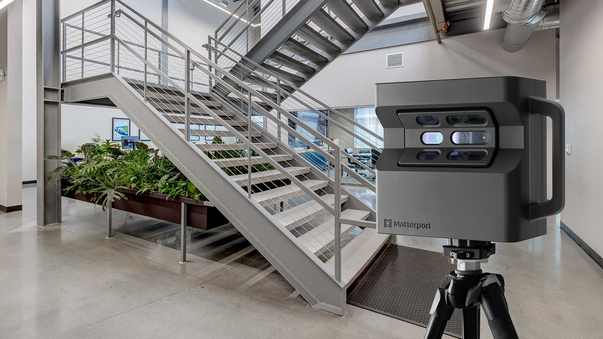
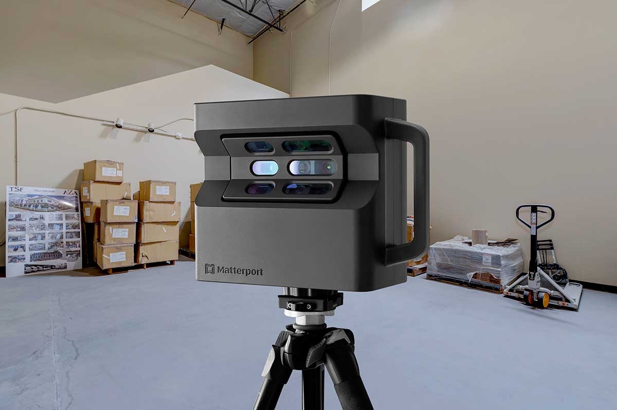
Rick utilizes enterprise-grade Matterport Pro2 technology—the industry standard for commercial real estate—to capture high-resolution 3D scans. By providing accurate As-Built spatial data and schematic floor plans, our Matterport tours reduce unqualified showings, empower out-of-state capital to make data-driven decisions, and significantly compress the commercial leasing and acquisition cycle.
Las Vegas commercial Matterport scans and virtual tours interface for remote due diligence

Comprehensive 3D Spatial Services for Commercial Assets

Professional 3D scanning technology engineered for B2B property marketing and architectural planning.

Enterprise Matterport Pro2 Capture

Industry-leading 3D capture technology for massive commercial footprints. High-resolution scanning with 99% dimensional accuracy. Detailed documentation of every room, warehouse bay, and MEP infrastructure layout.

Interactive Digital Twins

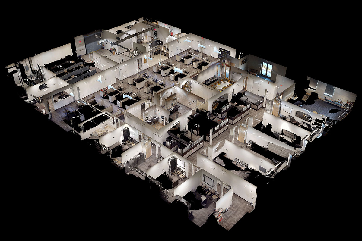
Fully immersive virtual reality walkthroughs viewable on any device. Utilize Mattertags to highlight key HVAC specifications, electrical panels, and structural assets. Dollhouse views for complete spatial understanding.

Schematic Floor Plans & As-Builts

Generate schematic floor plans directly from the 3D scan to verify accurate square footage and room dimensions. 2D and 3D floor plan exports available for purchase at wholesale directly through your Matterport account.

BIM & CAD-Compatible Files (E57/OBJ)

Bridge the gap to architecture. Generate high-density point clouds (E57) and OBJ files for direct integration with AutoCAD, Revit, and other BIM software. Provide precise spatial data to architects for rapid Tenant Improvement (TI) planning.

OM & Platform Integration

Embed directly into LoopNet, CoStar, CREXI, and digital Offering Memorandums. Share via secure link or QR code for frictionless access by out-of-state brokers, institutional capital, and underwriting teams.

Direct Account Ownership

Unlike other photographers who trap your data on their servers, RCRdigital sets you up with your own Matterport account. We manage the uploads, but you maintain full ownership of your architectural assets with zero markup on hosting fees.

Remote due diligence and investor presentations using Matterport CAD and 3D virtual tours

Why Commercial Assets Demand 3D Data

Remote Institutional Due Diligence

Out-of-state investors, REIT boards, and national retail tenants can conduct thorough, millimeter-accurate property evaluations remotely. Matterport tours eliminate the need for expensive, time-consuming executive site visits.

Pre-Qualify Corporate Tenants

3D tours pre-qualify corporate prospects by allowing them to virtually walk through Vanilla Shells before scheduling in-person visits. This prevents wasted tours and filters for high-intent leasing prospects.

Accelerated Tenant Improvements (TI)

Our Pro2 cameras capture precise spatial data. Architects and space planners can generate As-Built layouts and plan tenant improvements (TI) directly from the 3D model, saving weeks of manual drafting and site measurement.

Verify Clear Heights & Logistics Flow

For office buildings, retail centers, and industrial warehouses, spatial understanding is critical. Matterport's dollhouse view instantly communicates spatial relationships, clear heights, and ingress/egress flow for logistics.

Highlight Infrastructure with Mattertags

Use Matterport's tagging system to pin spec sheets directly to important infrastructure: HVAC systems, loading docks, electrical panels, and structural capacities. Tags provide instant data room access that justifies property value.

Experience Our Matterport 3D Tours

Explore interactive walkthroughs of Las Vegas commercial properties—click and drag to navigate the digital twin.

Commercial Property Tour Example 1

Click and drag to explore this commercial space in 3D

Commercial Property Tour Example 2

Navigate through this property using your mouse or touch screen

These interactive 3D tours demonstrate how Las Vegas commercial real estate virtual tours allow capital partners to evaluate properties remotely. Tours embed directly on LoopNet, CoStar, CREXI, and your digital OMs.

The RCRdigital Matterport Difference

10+ years of professional 3D scanning and spatial data capture for Las Vegas commercial real estate.

Professional Matterport Pro2 Camera

We use the industry-standard Pro2 camera, not consumer-grade 360 equipment. Superior resolution and millimeter accuracy for commercial properties. Reliable point-cloud generation for properties of any scale.

Commercial Real Estate Expertise

With years working directly inside a major Las Vegas commercial brokerage, Rick understands what features matter to commercial tenants, REITs, and architects. Our strategic scanning approach highlights your asset's true structural value.

Seamless Integration with Photography

Combine 3D tours with ground HDR photography and corporate capture drone shots. Secure comprehensive visual marketing and engineering data from a single provider. Discounted package pricing when combining services.

Free Account Management

We manage your personal Matterport account at no additional cost. Archive tours when properties lease to free up space. Order schematic floor plans and E57 CAD exports at true wholesale pricing.

Quick 1-2 Day Delivery

Matterport tours processed and delivered within 1-2 business days. Rush service available for urgent listing deadlines or architectural site reviews. Coordinated delivery with photography and drone services.

Cost-Effective SqFt Model

Transparent pricing starting at $0.035 - $0.05 per square foot. The larger the property footprint, the lower the rate. You own your digital twins through your own account with zero photographer hosting markup.

Simple Matterport 3D Tour Process

Professional B2B scanning with transparent pricing and direct spatial data ownership.

1

Request Free Square-Footage Quote

Contact RCRdigital to discuss your commercial property. We provide a transparent quote based on our $0.035 - $0.05/sqft model and explain the entire process, including how to set up your Matterport account.

2

Create Your Matterport Account

Set up your own Matterport Pro account (we'll guide you through this simple process). This ensures you own and control your 3D digital twins while paying only wholesale Matterport hosting fees. RCRdigital will be added as a contributor to manage tours on your behalf.

Why Your Own Account?

  • Lower Costs: We charge significantly less because we don't mark up Matterport hosting.
  • Full Ownership: You control your tours and pay hosting only while actively marketing.
  • Wholesale Pricing: Direct access to wholesale rates on schematic floor plans and E57/OBJ CAD exports.
  • Free Management: We handle archiving, floor plan orders, and technical support.
3

Schedule Property Scan

Book a convenient time for your property scan. We coordinate with your schedule and tenant operations to minimize disruption. Typical scan times:

  • 5,000-10,000 sq ft office/retail: 1-2 hours
  • 10,000-25,000 sq ft: 2-3 hours
  • 25,000+ sq ft industrial/flex: 3-4+ hours
4

Professional On-Site Scanning

Rick arrives with professional Matterport Pro2 equipment and systematically scans your property. We capture every room, hallway, common area, and MEP focal point. Strategic scan placement ensures smooth virtual walkthrough experiences and dense point cloud data.

5

Direct Upload & Processing

Scans are uploaded directly to your Matterport account for processing. Matterport's cloud system compiles the spatial data, generating the 3D model, dollhouse view, and enabling CAD extraction.

6

Tour Delivery & Integration

Once processing is complete, you have instant access to:

  • Direct link to your 3D tour for digital OMs
  • Embed code for your website
  • Instructions for LoopNet, CoStar, and CREXI integration
  • One-click ordering for Floor Plans and E57 engineering files
7

Ongoing Account Management (Free)

RCRdigital manages your Matterport account at no charge:

  • Archive tours when properties lease (frees space in your subscription)
  • Execute architectural extraction orders (CAD/BIM)
  • Provide technical support and Mattertag updates as needed

Why Opening Your Own Matterport Account Saves Money

Significant Cost Savings

Most commercial photographers mark up their services heavily to cover their own hosting costs. RCRdigital charges only for the scanning service ($0.035 - $0.05/sqft)—you pay Matterport directly for hosting. This transparent model saves developers and brokers hundreds of dollars per property.

You Own Your Data Assets

Your 3D spatial data is permanently yours. Even if you stop working with RCRdigital, your digital twins remain in your Matterport account under your control. No vendor lock-in, no losing access to the engineering assets you paid for.

Wholesale CAD Add-On Pricing

Order schematic floor plans, E57 high-density point clouds, and Revit-ready BIM files directly from Matterport at wholesale prices—no photographer markup. RCRdigital will help your architects execute these orders at no additional fee.

Flexible Asset Management

Keep tours active only while marketing properties or executing TIs. Archive them when properties lease to free subscription space. Reactivate archived spatial data anytime if needed for future renovations.

Commercial Properties That Require 3D Data

Office Buildings - Show floor plans, conference rooms, common areas, and professional environments to attract quality corporate tenants. Generate As-Builts for custom build-outs.

Retail Centers - Demonstrate store layouts, customer flow, anchor tenant spaces, and Vanilla Shell potential for out-of-state franchises.

Industrial Warehouses - Reveal clear heights, loading docks, office build-outs, and precise spatial configurations for logistics companies planning racking systems.

Multi-Family Complexes - Showcase unit layouts, amenity spaces, clubhouses, and community features to real estate investment trusts (REITs) conducting remote due diligence.

Medical Facilities - Document exam rooms, waiting areas, procedure spaces, and highly technical MEP compliance features for specialized healthcare networks.

Hotels & Hospitality - Present room layouts, ballrooms, meeting spaces, and guest amenities to event planners and institutional investors.

Licensed Matterport Services Throughout Las Vegas Metro

Professional 3D scanning for commercial properties across Southern Nevada

Henderson

Green Valley, Black Mountain, Henderson Business District

Summerlin

Downtown Summerlin, Summerlin Centre, Red Rock Business District

North Las Vegas

Apex Industrial, North Las Vegas Airport logistics area

Las Vegas

The Strip corridor, Downtown Las Vegas, Spring Valley

Southern Highlands

Commercial corridors and retail centers

All Las Vegas Metro

We mobilize to any commercial property location

Frequently Asked Questions

Common questions about Matterport CAD extraction and virtual tours

What is a Matterport 3D digital twin?

A Matterport 3D virtual tour is an immersive, interactive digital replica that allows viewers to virtually walk through a commercial property as if they were physically present. For Las Vegas commercial properties, virtual reality tours for commercial real estate provide out-of-state investors and national tenants the ability to conduct thorough property evaluations remotely, reducing unnecessary site visits while accelerating the due diligence phase.

How long does it take to scan a commercial property?

Scanning time depends on property footprint and complexity. A typical 5,000-10,000 sq ft office or retail space takes 1-2 hours to scan. Properties between 10,000-25,000 sq ft typically require 2-3 hours. Larger industrial warehouses or multi-building complexes over 25,000 sq ft may need 3-4+ hours. Rick works efficiently to minimize disruption to your tenant operations.

Why do I need my own Matterport account?

Opening your own Matterport account provides significant cost savings and total data ownership. Most photographers mark up hosting fees. RCRdigital charges only for the scanning service based on square footage ($0.035 to $0.05/sqft). We upload directly to your account, so you pay Matterport directly for hosting at wholesale rates. This ensures you permanently own your architectural data without vendor lock-in.

Can Matterport tours be embedded on LoopNet and CoStar?

Yes! Las Vegas commercial Matterport scans integrate seamlessly with LoopNet, CoStar, and CREXI—the primary commercial real estate listing platforms. Each Matterport tour generates a unique embed code that can be inserted directly into your digital OMs and property listings, allowing prospects to virtually walk through properties without leaving the platform.

What's the difference between Matterport and a standard video tour?

Video tours are linear marketing experiences. Matterport 3D tours are fully interactive spatial data assets. In commercial real estate, Matterport is highly valuable because it provides dimensional accuracy, allowing architects, engineers, and space planners to extract CAD-ready data to calculate Tenant Improvement (TI) costs remotely.

Can Matterport generate floor plans, BIM, and CAD files?

Yes! Matterport tours are a bridge to architectural planning. Schematic floor plans are generated from the 3D scan showing accurate As-Built layouts. For engineering purposes, Matterport can generate high-density point clouds (E57), OBJ formats, and Revit-ready BIM files, providing precise spatial data for renovation planning and tenant fit-outs. Because you own the hosting account, you order these at true wholesale prices.

How much does a commercial Matterport 3D scan cost?

RCRdigital's Matterport 3D scanning service utilizes a transparent scale based on square footage, ranging from $0.035 to $0.05 per square foot. The larger the commercial space, the lower the per-square-foot rate. This pricing covers the professional scanning service and direct upload to your Matterport account. Contact RCRdigital for a free, exact quote specific to your commercial property's footprint.

Can Matterport be combined with ground photography and drone services?

Absolutely! We strongly recommend combining Matterport 3D spatial capture with ground HDR photography and corporate capture drone services. When booked together, these services create a comprehensive visual due diligence package. Everything is coordinated in a single visit, delivered together within 1-2 business days, and formatted consistently for commercial capital markets.

Digitize Your Commercial Asset with Matterport

Las Vegas commercial real estate virtual tours provide the immersive, data-rich spatial accuracy that helps properties lease faster to qualified out-of-state corporate tenants. Whether you're marketing an office building in Henderson, a retail center in Summerlin, or an industrial warehouse in North Las Vegas, RCRdigital delivers the exact visual technology needed for architectural planning and CoStar supremacy.

Contact Rick Rowland today for a free $0.035 - $0.05/sqft quote on Matterport 3D scanning—or ask about our discounted packages combining spatial data with ground HDR photography and aerial drone imagery.