
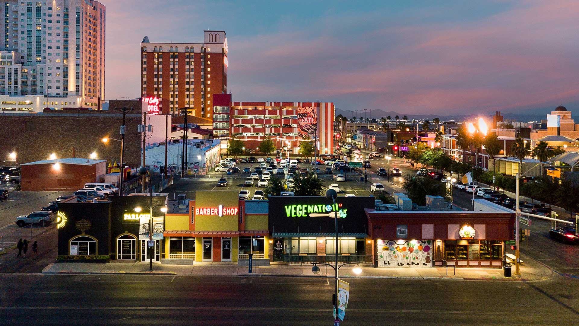
Las Vegas Corporate Capture & Commercial Drone Photography
Strategic Aerial Data for Commercial Leasing and Capital Markets
Rick Rowland is an FAA Part 107 certified commercial drone pilot providing high-level corporate capture commercial real estate drone photography throughout Las Vegas. With extensive commercial brokerage experience, RCRdigital captures the critical spatial data—site layout, ingress/egress, parking ratios, and surrounding infrastructure—required for Offering Memorandums (OMs), investor pitch decks, and premium LoopNet/CoStar listings. We deliver the exact visual assets developers, REITs, and brokers need to drive commercial transactions.
Professional Aerial Photography That Showcases Your Property's Full Potential
Commercial drone photography provides perspectives that ground-level photography simply cannot capture. Rick Rowland's FAA-licensed drone services reveal critical property features that matter to commercial tenants and investors: total site layout, building footprints, parking capacity, loading dock access, proximity to highways and major traffic arteries, neighboring businesses, and surrounding development. For industrial properties in North Las Vegas, retail centers in Henderson, office parks in Summerlin, and multi-family complexes throughout Las Vegas, aerial photography demonstrates scale, accessibility, and location advantages that drive leasing decisions.
As a Part 107 certified commercial drone pilot, Rick operates legally and safely, following all FAA regulations. Our aerial HDR photos integrate seamlessly with ground-level HDR photography and Matterport 3D tours, providing comprehensive visual marketing packages optimized for LoopNet, CoStar, and CREXI platforms.
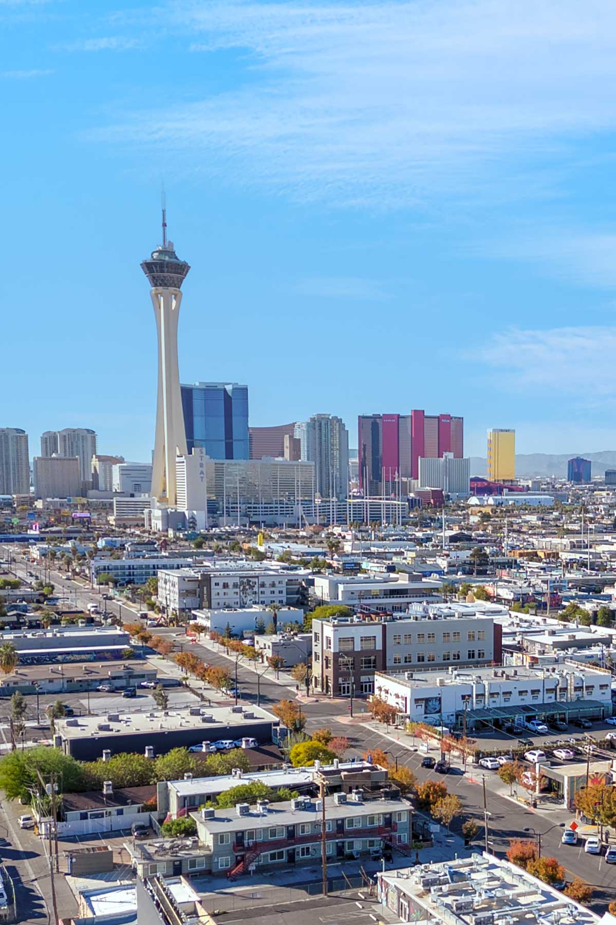
Commercial Aerial Photography Portfolio
Professional drone photography examples from Las Vegas commercial properties
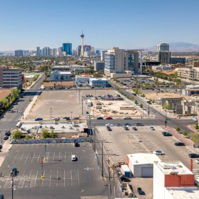
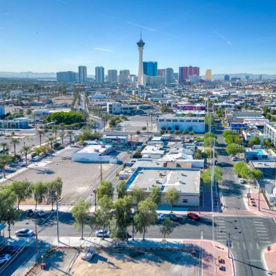
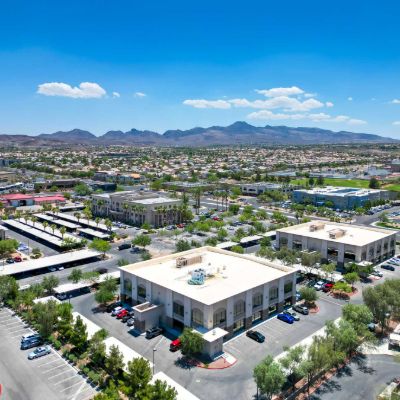
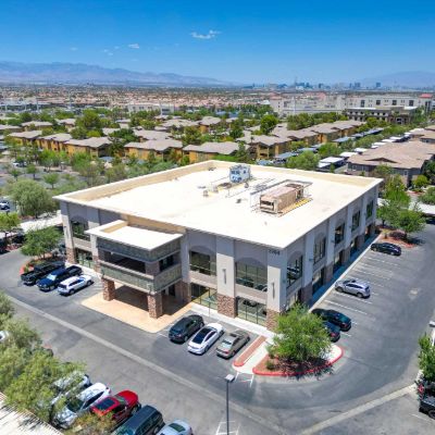
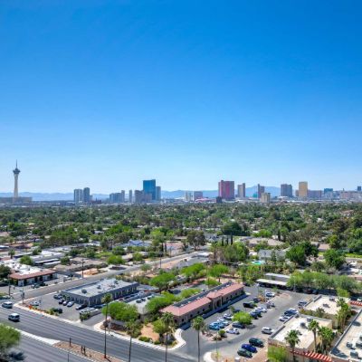
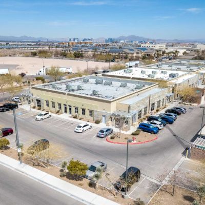
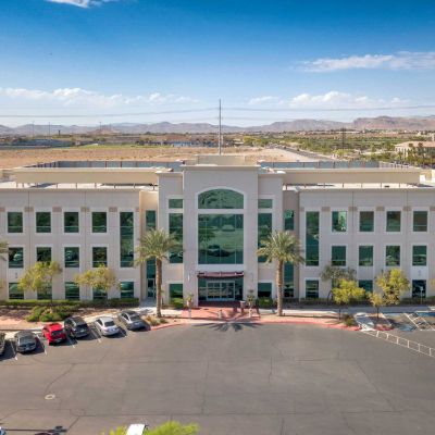
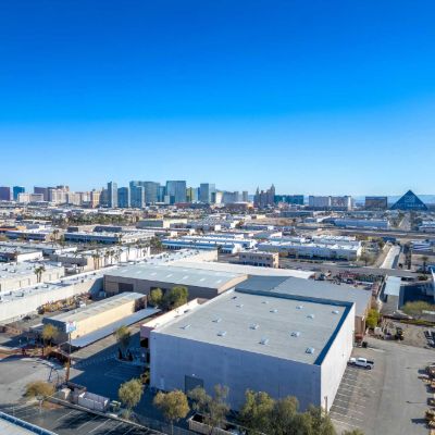
Comprehensive Aerial Photography Package for Commercial Properties
Professional drone services designed for commercial property marketing and leasing.
FAA Part 107 Licensed & Compliant
Fully licensed commercial drone pilot operating legally throughout Las Vegas. Full compliance with all FAA regulations, LAANC authorizations, and safety protocols for corporate and industrial assets.
High-Resolution Aerial HDR
Professional HDR aerial photos capturing site context and property scale. Multiple angles: overhead, oblique, and perspective shots. High-resolution files perfect for Offering Memorandums (OMs) and large-format displays.
Site Context & Accessibility Documentation
Showcase proximity to highways, major roads, and traffic arteries. Highlight parking layouts, loading docks, and truck access routes for logistics tenants. Demonstrate neighboring businesses and surrounding development.
Comprehensive Corporate Capture
Multiple aerial perspectives showing property from all key angles. Overhead shots revealing site layout and building footprints. Oblique angles showcasing building height, architecture, and structural assets.
Platform-Optimized Deliverables
Aerial photos formatted strictly for LoopNet, CoStar, and CREXI specifications. High-resolution files for investor pitch decks. Web-optimized versions ready for immediate marketing deployment.
Quick 1-2 Day Turnaround
Aerial photography delivered within 1-2 business days. Rush service available for urgent capital markets deadlines. Discounted pricing when combined with ground photography or Matterport scans.
Commercial Properties That Benefit Most from Aerial Photography
Drone photography is an essential data point for:
• Industrial & Warehouse Properties - Showcase massive square footage, loading docks, truck access, and site layout that's impossible to capture from ground level.
• Shopping Centers & Retail Plazas - Demonstrate parking capacity, storefront visibility, traffic patterns, and anchor tenant positioning.
• Office Parks & Business Campuses - Highlight building placement, landscaping, parking facilities, and professional environment.
• Multi-Family Complexes - Showcase community amenities, pool areas, parking, landscaping, and surrounding neighborhood context for REITs.
• Vacant Land & Site Selection - Provide critical topographical data, plot boundaries, utility proximity, and infrastructure access for developers.
• Hotels & Hospitality - Capture resort-style amenities, location advantages, and property appeal from dramatic aerial perspectives.
Whether you're marketing a 100,000 sq ft warehouse in North Las Vegas, a retail center in Henderson, an office building in Summerlin, or an apartment complex anywhere in Las Vegas Metro, aerial drone photography provides the comprehensive visual context that helps commercial properties lease faster and attract qualified tenants.
The Competitive Advantage of Corporate Capture Data
Showcase Site Layout & Scale
Aerial photography reveals property dimensions, building footprints, and site layouts that are impossible to communicate through ground-level photos alone. Investors and tenants can immediately understand square footage and spatial relationships.
Demonstrate Location & Accessibility
Drone shots prove proximity to highways, major roads, airports, and commercial hubs. For industrial properties, showcase truck routes and freeway access. For retail, demonstrate traffic exposure and parking visibility.
Stand Out on Commercial Platforms
Listings with professional aerial photography receive significantly more views on LoopNet, CoStar, and CREXI. Drone imagery signals serious marketing investment, attracts qualified prospects, and helps properties command premium lease rates.
Corporate Capture & Stakeholder Data
Out-of-state investors, REITs, and corporate boards require comprehensive visual data to evaluate Las Vegas assets without traveling. Our corporate capture services provide the high-resolution aerials needed for remote due diligence.
Document Property Features
Aerial photography captures critical structural features: HVAC rooftop units, solar installations, parking lot striping conditions, landscaping quality, security fencing, loading dock configurations, and surrounding development.
Progress Documentation
For developers and new construction projects, corporate capture aerial drone photography provides professional progress documentation for investor updates, municipal approvals, pre-leasing campaigns, and certificate of occupancy reporting.
Why Choose RCRdigital for Commercial Drone Services
10+ years of FAA-licensed corporate drone photography for Las Vegas commercial real estate.
FAA Part 107 Certified & Legal
Fully licensed commercial drone pilot authorized to operate for commercial real estate. Many photographers offer drone services without proper FAA licensing—we operate legally with full compliance.
Commercial Real Estate Expertise
With 4 years working directly inside a major Las Vegas commercial brokerage, Rick understands what features matter to capital markets: parking ratios, truck access, site context. We're B2B marketing specialists.
Enterprise-Grade Equipment
Professional DJI enterprise drones with high-resolution cameras and HDR capability. Advanced flight planning for optimal coverage and perspectives. Backup equipment ensures we never miss a shoot.
Seamless Integration
Drone services integrate perfectly with our ground HDR photography and Matterport 3D tours. Comprehensive visual marketing packages from a single provider. Discounted pricing when combining services.
Platform-Optimized Delivery
Aerial photos formatted specifically for LoopNet, CoStar, and CREXI requirements. High-resolution files for investor presentations, OMs, and print materials. Web-optimized versions ready for immediate upload.
Weather-Adaptive Scheduling
We monitor Las Vegas weather conditions and reschedule if necessary for optimal quality. Flexible scheduling accommodates tenant operations and property access requirements. Rush service available.
Licensed Drone Services Throughout Las Vegas Metro
Professional aerial photography for commercial properties across Southern Nevada.
Henderson
Green Valley, Black Mountain, Henderson Business District
Summerlin
Downtown Summerlin, Summerlin Centre, Red Rock Business District
North Las Vegas
Apex Industrial, North Las Vegas Airport area
Las Vegas
The Strip corridor, Downtown Las Vegas, Spring Valley
Southern Highlands
Commercial corridors and retail centers
All Las Vegas Metro
We travel to any commercial property location
Professional, Safe, Efficient Aerial Photography Workflow
FAA-compliant drone operations with comprehensive planning and execution.
Consultation & Site Assessment
Discuss property features, marketing goals, and desired aerial shots. Review FAA airspace restrictions and property access requirements. Confirm shoot timing based on optimal conditions.
FAA Compliance & Authorization
Verify all FAA regulations and airspace authorizations. Obtain necessary LAANC approvals for controlled airspace if required. Coordinate with property managers on flight operations.
Pre-Flight Planning
Scout property location and plan flight paths for optimal coverage. Identify key features to highlight: parking, loading areas, site context. Check weather conditions and confirm shoot window.
On-Site Aerial Photography
Professional drone operations capturing high-resolution aerial HDR photos. Multiple angles: overhead shots, oblique perspectives, and contextual views. Adds 30-45 minutes to photography session.
Professional Editing
HDR processing for aerial photos with optimal color and exposure. Perspective correction and enhancement for maximum impact. Quality control review ensuring all key property features are captured.
Delivery & Integration
Aerial photos delivered within 1-2 business days via secure download. Files organized and formatted for immediate use on LoopNet, CoStar, CREXI. Seamlessly integrated with ground photography.
Maximum Marketing Impact with Integrated Visual Solutions
While drone photography alone provides powerful aerial perspectives, the greatest marketing impact comes from comprehensive visual packages that tell your property's complete story. RCRdigital offers significant discounts when you combine drone aerials with ground HDR photography and Matterport 3D tours—creating a complete visual marketing solution from a single provider.
Complete Marketing Package
- Ground HDR Photography
- Aerial Drone Photography
- Matterport 3D Virtual Tour
- Discounted bundle pricing
- Single shoot coordination
- 1-2 day delivery
Aerial + Photography
- Professional ground photos
- Aerial HDR photography
- Comprehensive coverage
- Optimized for all platforms
- Volume discount pricing
Aerial + 3D Tour
- Matterport 3D walkthrough
- Aerial site context shots
- Integrated marketing assets
- Perfect for remote investors
Frequently Asked Questions
Common questions about corporate capture commercial drone photography in Las Vegas.
Yes! Rick Rowland is an FAA Part 107 certified commercial drone pilot, which is the federal legal requirement for anyone operating drones for commercial asset capture in the United States. Many photographers offer "drone services" without proper FAA licensing, which is illegal and puts your brokerage or REIT at massive liability risk. Our Part 107 certification means we've passed rigorous FAA testing on airspace regulations, weather considerations, flight operations, and safety protocols.
RCRdigital provides FAA-licensed drone photography throughout the Las Vegas metropolitan area, including Henderson, Summerlin, North Las Vegas, Boulder City, and all of Southern Nevada. However, certain areas have airspace restrictions that require special FAA authorization. For example, properties near Harry Reid International Airport, Nellis Air Force Base, and certain downtown areas require LAANC (Low Altitude Authorization and Notification Capability) approval before we can fly. We handle all FAA authorizations and airspace coordination as part of our service—you don't need to worry about compliance issues.
A typical commercial drone session adds 30-45 minutes to your overall photography appointment, though timing varies based on property size. For a standard office building or retail center, we can capture comprehensive aerial coverage in 30 minutes. Larger industrial properties, multi-building complexes, or massive vacant land parcels may require 45-60 minutes for complete aerial documentation. We work efficiently to minimize disruption to your tenant operations and business activities.
Safe and high-quality drone photography requires specific weather conditions. We need clear or partly cloudy skies with winds below 20 mph for safe operations and optimal photo quality. Rain, fog, heavy clouds, or high winds prevent us from flying safely and would produce poor-quality images. Las Vegas weather is generally favorable for drone operations most of the year, but we continuously monitor conditions leading up to your scheduled shoot. If weather becomes unfavorable, we'll contact you immediately to reschedule at no charge. We'd rather reschedule than deliver subpar aerial photos that don't effectively market your commercial property.
Yes! Rick has extensive experience conducting drone operations at occupied commercial properties throughout Las Vegas. We work professionally and efficiently to minimize disruption to tenant operations. For occupied properties, we coordinate with property managers to schedule flights during times that work best for your tenants—often early morning, lunch hours, or after business hours.
RCRdigital's commercial corporate capture service includes: FAA Part 107 licensed operations; high-resolution aerial HDR photos from multiple angles (overhead, oblique, and perspective shots); comprehensive coverage showing site layout, parking, loading areas, building placement, and surrounding context; professional editing with color correction and perspective adjustment; and platform-optimized deliverables formatted for LoopNet, CoStar, and CREXI. All aerial images include unlimited usage rights with no watermarks or licensing restrictions.
Yes, vacant land drone photography in Las Vegas is a major component of our corporate capture services. When marketing large parcels of undeveloped land in the Las Vegas Valley or surrounding desert, ground-level photos simply cannot communicate the scope of the property. Our aerial imagery helps developers and corporate investors understand topography, exact plot boundaries, proximity to utilities, and access routes for construction logistics.
RCRdigital's standalone commercial drone photography starts at just $125. This highly competitive price is even lower when bundled with other services, such as ground photography or Matterport scans. The final cost depends on the commercial property size, acreage, and the number of aerial angles required. A single-building retail center costs less than a sprawling multi-building industrial park. Contact RCRdigital for a free, itemized estimate.
Absolutely! In fact, we strongly recommend combining services to capture the holistic visual data that commercial brokers and capital markets require. When you book ground HDR photography as your primary service, adding drone aerials and Matterport 3D tours is significantly discounted since we're already on-site. All three services are coordinated in a single visit, delivered together within 1-2 business days, and formatted consistently.
Ready to Elevate Your Commercial Real Estate Listings?
Professional HDR photography, corporate capture drone aerials, and 3D tours strictly optimized for LoopNet, CoStar, and Offering Memorandums.
Request Quote