In the high-stakes world of commercial real estate, relying on ground-level photography to market a multimillion-dollar asset is no longer sufficient. Out-of-state investors, Real Estate Investment Trusts (REITs), and corporate development boards require comprehensive, high-level visual data to make informed decisions and accurately calculate Cap Rates.
Enter corporate capture—the industry standard for securing high-resolution, data-rich aerial imagery for B2B applications.
But what exactly is corporate capture, and how does it differ from standard drone photography? For commercial brokers, developers, and property managers in the Las Vegas valley, understanding this distinction is the key to creating Offering Memorandums (OMs) that command premium valuations and close deals faster.
Beyond "Pretty Pictures": The Definition of Corporate Capture
Standard real estate drone photography is often focused on simple aesthetics—capturing a nice sunset over a house to make a residential MLS listing look appealing to a homebuyer.
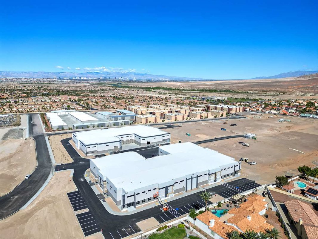
Corporate capture commercial real estate aerial drone photography is fundamentally different. It is a strict B2B service focused on scale, contextual data, and legal liability. It is the process of using enterprise-grade drone technology to document the critical physical and logistical attributes of a commercial asset for stakeholder review.
Corporate boards and remote investors aren't looking for a cinematic masterpiece; they are looking for objective data that answers million-dollar questions:
- What is the exact footprint and roof condition of the building?
- How many loading docks are accessible for 18-wheelers at this industrial logistics center?
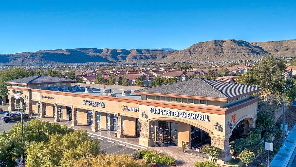
- What is the parking ratio and retail VPD (Vehicles Per Day) during peak hours?
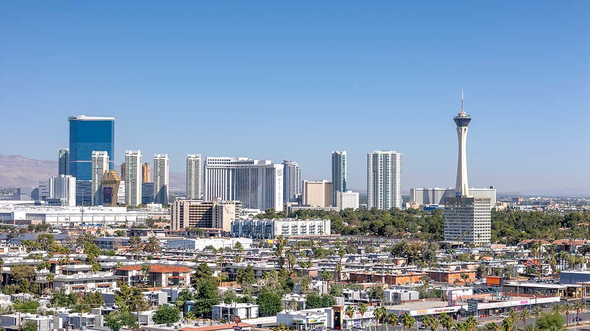
- How close is the property to the I-15 logistics corridor, the 215 Beltway, or the Las Vegas Strip?
Corporate capture answers these questions instantly by providing oblique angles, top-down site mapping, and contextual proximity shots that showcase neighboring developments, anchor tenants, and critical infrastructure.
Marketing Vacant Land and Commercial Site Selection
One of the most vital applications of corporate capture in Southern Nevada is vacant land drone photography.
Las Vegas is surrounded by rapidly developing desert corridors, and marketing a 50-acre parcel of undeveloped land with ground-level photos is nearly impossible. A picture of dirt and sagebrush tells a developer nothing about the site's potential.
Through corporate capture, an FAA-licensed drone pilot provides the vital visual data required for commercial site selection. Aerial imagery allows developers to assess the topography of the land, visualize exact plot boundaries, and determine proximity to municipal utilities. Whether the land is slated for a massive retail center in Summerlin or a new multi-family apartment complex in North Las Vegas, drone data is the mandatory first step in the institutional due diligence process.
Construction Progress and AIA Draw Requests
Corporate capture isn't just for finished assets. For General Contractors (GCs) and commercial developers, aerial data is a critical project management tool.
Routine, time-stamped drone flights provide the objective visual proof required to satisfy AIA billing and bank draw requests. By consistently documenting new construction progress—from initial site grading and foundation pours to vertical steel framing and roof dry-ins—developers can ensure their lender funding releases are never delayed. It also provides out-of-state equity partners with a transparent view of the job site without requiring them to fly to Nevada.
Mitigating Corporate Liability in Las Vegas Airspace
Perhaps the most critical element of "corporate capture" is the word corporate. Corporations, lenders, and national brokerages are highly risk-averse and heavily insured.
If a commercial broker hires an unlicensed hobbyist with a drone to photograph a retail center, and that drone causes property damage or violates federal airspace, the corporate entity can be held financially and legally liable.
Las Vegas has incredibly complex and heavily restricted airspace regulations due to the heavy air traffic from Harry Reid International Airport, North Las Vegas Airport, and Nellis Air Force Base. True corporate capture requires an FAA Part 107 Certified Commercial Drone Pilot who is fully insured for commercial liability.
A professional commercial operator handles all Low Altitude Authorization and Notification Capability (LAANC) approvals and FAA waivers seamlessly. This guarantees that your aerial marketing assets are captured 100% legally, entirely mitigating risk for your corporate stakeholders.
Integrating Aerial Data into Your Marketing Strategy
Commercial properties targeting Triple-Net (NNN) leases that feature professional aerial photography receive significantly higher engagement on platforms like LoopNet, CoStar, and CREXI. By investing in corporate capture, you signal to the market that your asset is a premium investment opportunity backed by transparent, comprehensive data.
At RCRdigital, we bring over a decade of commercial real estate and brokerage experience to every flight. We integrate our aerial data seamlessly with ground-level HDR photography and Matterport 3D virtual tours to create the ultimate B2B marketing package.
Ready to elevate your next commercial listing? Explore our portfolio and learn more about our Las Vegas Commercial Aerial Drone Photography & Corporate Capture Services. Contact RCRdigital today to request a custom quote and keep your massive commercial projects legally compliant and visually stunning.